Anticlinal fold – Yandoit (near Daylesford), central Victoria
Location: Yandoit-Werona Rd, approximately 500 m west of the intersection with Yandoit Creek Rd. (Streetview link).
Age: Ordovician
Rock type: Sedimentary > Clastic > Deep marine (turbidite).
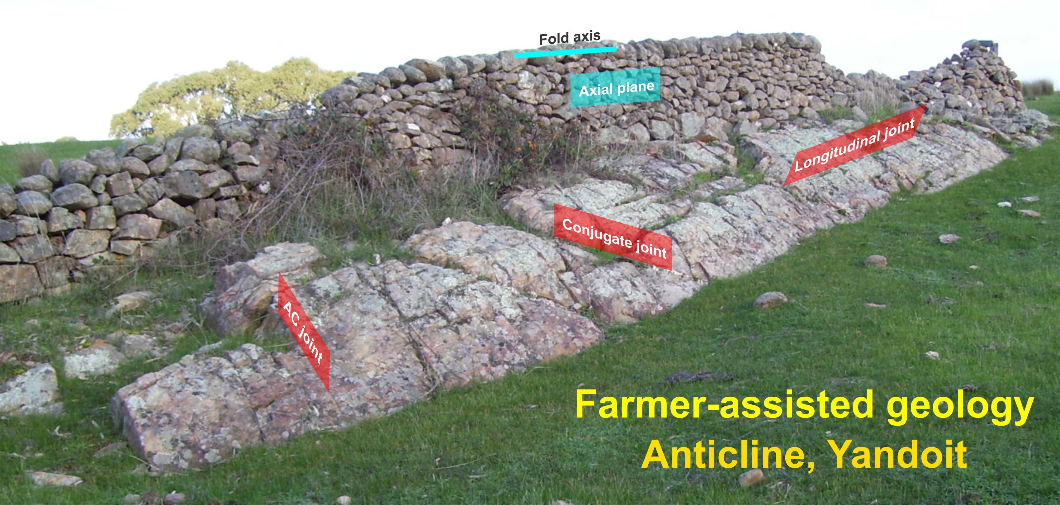
Site features: The local farmer has greatly assisted to define the geology. The fence is constructed along the axial plane of the fold. The line of rocks along the top of the fence defines the plunge of the gold (fold axis).
Geological features: A great example of an anticline. A sandstone bed outcrops and rolls over to create the fold. Text-book joints (natural fractures) patterns can be observed in the sandstone including AC joints, longitudinal joints and conjugate joints.
Geological evolution: Deep marine sediments (turbidites) were deposited at the bottom of a vast ocean that covered most of Victoria at the time (during the Ordovician). The old shoreline at that time was the Grampians. Subsequently these rocks were the folded into large mountain ranges and eroded to form the landscape today. The fold at this site is a result of the compression associated with the mountain building events.